
Walking a Union County Street Directory
Union County keeps the address route and the deed route in different places. Tax Administration and UC Atlas turn a street address into a parcel and an owner clue. The Register of Deeds then indexes recorded land documents by name, not by street. Public voter material can confirm a registration record within its legal limits, while a historical address directory can supply an older published household clue. That order reduces false matches and makes it clear whether a fact is current tax data, a recorded transfer, a registration status, or a dated publication.
- Enter the complete situs address in the Union County property portal. Preserve the parcel or property key, the owner name, the situs address, and any separate mailing address.
- Open UC Atlas, use Address Search or Street Name Search, then select the parcel with Identify or Cursor Select. Compare the map placement, street, subdivision, and nearby parcels.
- Use the owner name as a grantor or grantee search in the Register of Deeds land-record route. Follow the prior reference only when the parties and legal description match the parcel.
- Check public voter material only for a lawful, specific purpose. The public lookup is name-led, and any selected voter-list request must follow the limits in North Carolina law.
- For an older published address, consult the Monroe directory volumes or ask the library about a criss-cross copy. Record the volume year and its abbreviation key before connecting it to a modern parcel.
That sequence is an address research trail, not a roster. A tax mailing destination, a recorded owner, a permit participant, and a historical directory entry can refer to different people or dates.
Union County Street Records in Tax Administration
The county directs an address searcher to Tax Administration before the deed system because the deed system is name-based. The county-linked Spatialest portal exposes owner-name, property-address, and parcel or property-key routes, although its live matching rules and exact result-card layout were not captured in the research. Use the property-address route for the physical parcel. A tax card may connect the owner, situs address, mailing address, assessment context, acreage, building characteristics, and exemptions, but the exact set of displayed fields should be confirmed in the live result.
A situs address is the parcel's physical location. A mailing address is where tax correspondence goes. They can match, but they can also point to a trust, representative, family contact, or another location. Keep both values without calling either one a current occupancy finding. This distinction is especially useful when several similarly named streets occur across Union County municipalities and unincorporated areas.
- Parcel
- A mapped unit of land identified by the county for property and tax administration.
- Situs address
- The street address used to locate the physical parcel.
- Mailing address
- The address used for tax correspondence. It is not, by itself, a statement of who is present at the parcel.
- Plat
- A recorded map that can show a subdivision, lots, boundaries, and related legal context.
- Criss-cross directory
- A directory arranged by street and house number or telephone arrangement instead of surname order.
Note: Tax Administration supplies the address-to-parcel lead, while a recorded deed or survey controls the legal land description.
UC Atlas for Union County Streets
UC Atlas is the clearest street-browse tool in the Union County street directory process. It has Owner Name, Parcel Number, Address, and Subdivision Name modes, plus text entry for a street address or street name. After a result appears, the Layers, Search, and Results panels support a map review. Cursor Select and Identify open the selected map feature, while Acreage and Sales filters apply to the current map extent. The viewer also offers Print, Export to CSV, Measure, Draw, Zoom to Scale, and aerial layers for 2019, 2021, 2023, and 2025.
| UC Atlas field or tool | Type | Required | Street-use note |
|---|---|---|---|
| Address Search | Mode | No | Starts with a mapped address or address point. |
| Enter Street Name Search | Text | Not stated | Street-only search route; matching behavior was not exposed. |
| Parcel Number Search | Mode | No | Connects a known county parcel or property number to the map. |
| Subdivision Name Search | Mode | No | Helps when a street falls within a known subdivision. |
| Cursor Select / Identify | Map tools | Not stated | Selects a mapped feature and opens its available details. |
| Export to CSV / Print | Result controls | Not stated | Exports or prints selected map information, not a certified ownership list. |
The UC Atlas map and search interface shows the tools used to move from a Union County street to a mapped parcel.
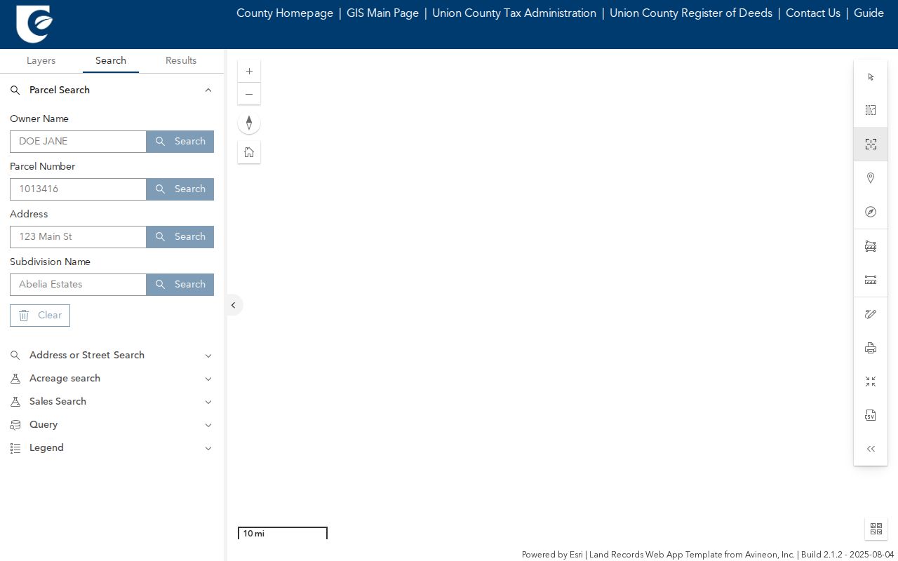
Use the map to orient the parcel and compare current layers, then use the appropriate custodian record for ownership or legal-boundary questions.
Address Sources Along Union County Streets
Several records can be tied to an address, but they do not carry the same weight. UC Atlas supplies mapped context and rapidly updated address points. Tax Administration supplies the current parcel path. Deeds and plats hold recorded transfer and legal-description evidence. A permit can document an application or inspection trail. The voter route is regulated and does not create a public browse of everyone on a street. Historical Monroe volumes are dated publications rather than current household evidence.
| Address-linked source | Custodian | Useful result | Access and limit |
|---|---|---|---|
| Tax parcel card | Tax Administration / Spatialest | Owner, situs and mailing addresses, parcel key, assessment context | Online portal; exact archive start and fields are not stated. Counter or request fallback remains available. |
| UC Atlas parcel map | GIS & Mapping | Parcel geometry, address point, aerial and layer context | Online map. Parcel edits are visible within one day; it is not a survey. |
| Recorded deed or plat | Register of Deeds | Parties, recorded transfer, legal description, and plat clues | Online deeds from 1973 and maps from 1842; all office records are available in person. |
| Permit record | Union Inspections / Evolve | Permit, parcel, date, type, and related project information | Public search needs no login; searchable coverage start is not stated. |
| Public voter material | NCSBE / Union Board of Elections | Permitted registration, address, status, precinct, and district fields | Name lookup or law-governed list request; protected fields and addresses are excluded. |
| Monroe directory | Library / DigitalNC | Published occupant, spouse notation, occupation, phone, and street address | Verified volumes are dated and do not establish a current household. |
The county's GIS and Mapping information explains that parcel boundaries and address points update quickly. That helps a current map search, but a recorded instrument remains the stronger source when boundary language matters.
From a Union County Street to Deeds
The Union County street directory has an important built-in switch: address-led Tax and GIS tools become a name-led deed search. Once the parcel record supplies an owner clue, search that name as a grantee or grantor in the Register of Deeds route. Read the prior reference, parties, and legal description before stepping backward. A subdivision plat can explain a lot number, while an older deed may use a legal description that does not look like a modern street address.
The Register of Deeds says the public website has deeds from 1973 and maps from 1842, while all records remain available in person. That is a useful comparison between quick online discovery and the fuller counter record. The online system covers deeds and plats, not mortgage information. For mechanics liens and judgments, the county directs researchers to the Clerk of Superior Court. Do not infer an online address field or a complete image layout, because the inspected county material did not expose those details.
Union County's split search logic is a local quirk: Tax and GIS are address-led, the deed index is name-led, the voter lookup needs a person's first and last name, and a criss-cross directory, if located, is street-led. Changing tools as the question changes is more reliable than forcing every fact through one search box.
Permit Dates on Union County Streets
Union County Building Code Enforcement uses Evolve Public for existing permit searches. The public search does not require an account. Its exposed routes include date range, subdivision or lot, permit number, tax parcel, and contractor. A result can place a permit or inspection activity at an address and date, but it is not a recorded title transfer. The researched county material did not state the first year of the searchable Evolve archive, and it did not expose a stable result card with every field.
For a code or zoning matter that does not appear there, request the record by address and date from the relevant county or city department. No consolidated county or city code-case index was located. This prevents a missing portal result from being mistaken for proof that no record exists.
The Union County Evolve Public permit search is the address-related permit route captured for this street directory.
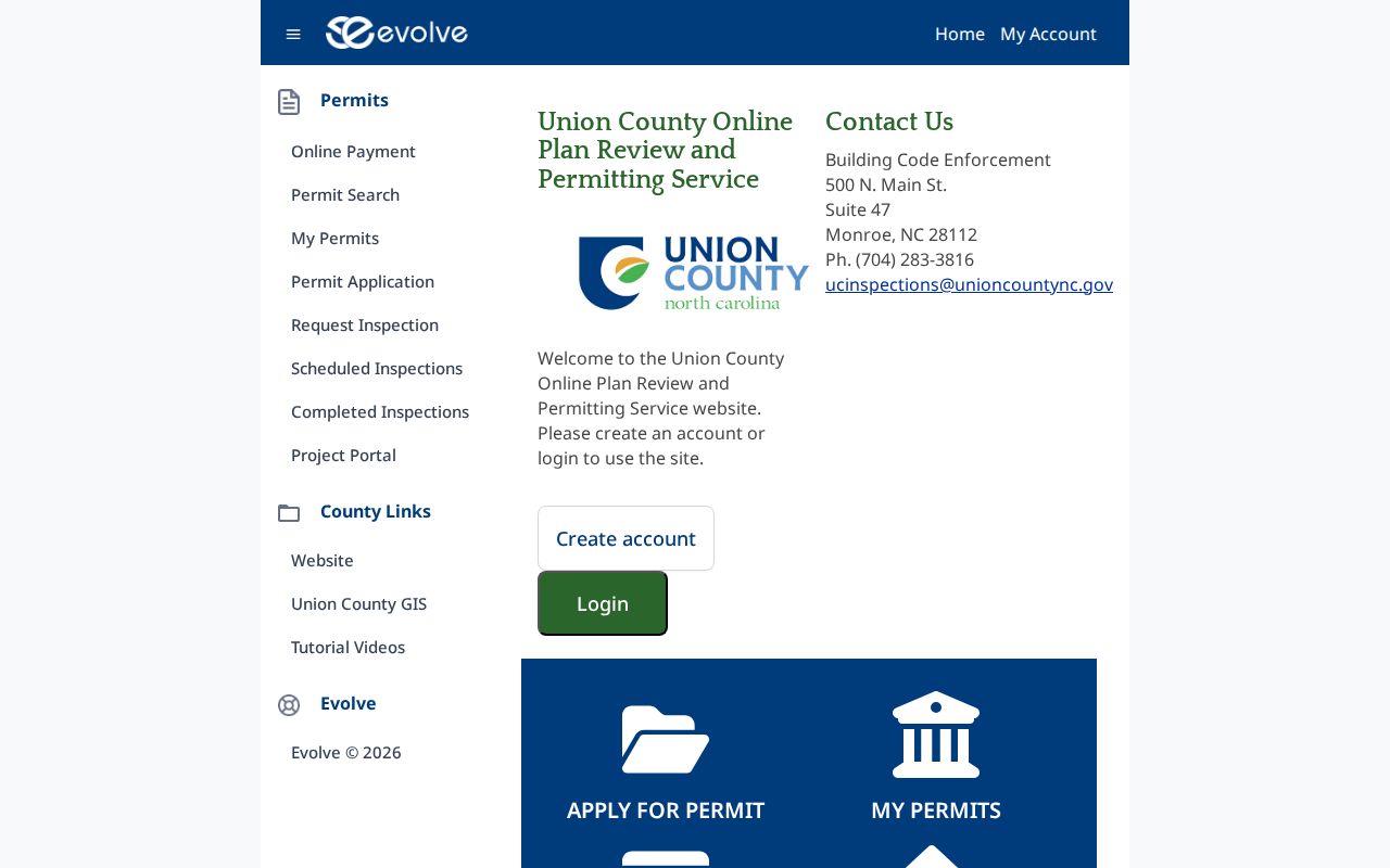
Compare the permit address and parcel clues with the map and tax record, then label the result as permit evidence rather than ownership evidence.
Note: Permit search access is public, but applications and inspection scheduling require an account and the archive start date is not stated.
Union County Street Directory Voter Limits
The NCSBE Voter Search is a name-led tool. It requires first and last names, with optional middle initial, year of birth, county, and status choices. It is not a street-wide browse button. A public match may show permitted registration details, jurisdictions, polling-place material when available, and voter history, but it does not disclose a full date of birth or a ballot choice.
North Carolina General Statute 163-82.10 allows a county board to provide a registered-voter list, with actual preparation costs reimbursed. The law permits selected lists by factors such as precinct, district, party, registration date, and voter history. The permitted electronic fields are still limited, and protected-address rules apply. Ask the Union County Board of Elections for the current estimate, format, and delivery information before requesting a large file. A registration address supports only a dated registration claim, not a statement about every occupant.
Township Keys in Union County Street Records
The first two digits of a Union County Property Key identify one of nine townships: New Salem, Marshville, Lanes Creek, Buford, Jackson, Sandy Ridge, Vance, Goose Creek, or Monroe. That prefix can be a fast navigation clue when a mailing city, ZIP label, and municipal boundary do not line up. It is not a street number, a city-limit test, or a legal description. UC Atlas and the deed or plat remain the better sources for the parcel's actual mapped and recorded context.
Modern place labels cross these townships. Vance reaches Weddington, Wesley Chapel, Indian Trail, Stallings, and Hemby Bridge, while Goose Creek reaches Monroe, Fairview, Unionville, and Indian Trail. This geography explains why a street search should preserve the county property key and subdivision context instead of relying on a mailing label alone.
Historic Union County Street Entries
Older address evidence in Union County is strongest when it is described as a publication, not a current list. Verified Monroe city-directory volumes include 1922-23, 1942-43, 1951-52, 1955-56, 1958-59, 1960-61, and 1962-63. They can contain a name, spouse notation, occupation, telephone information, and street address. The digitized 1951-52 Monroe directory is one example of the historical collection.
A local Monroe criss-cross run with exact shelf years was not verified online. The Library of Congress describes the method, but the local record is a research gap. Ask the Dickerson Room or special collections for a street-arranged copy, its year range, and its abbreviation key. For fuller historical directory research, use the Union County City Directory rather than treating a single volume as a complete street history.
Street names, intersections, subdivision lots, and legal descriptions can change the search path between a historical volume and a current map. No official county street-renumbering year or address-continuity crosswalk was located. Search variants and compare the directory, a 1908 Monroe Sanborn sheet, and current parcel context before deciding an address has disappeared.
Missing Union County Street Records
A missing online result often means a different access channel is needed. The Register of Deeds provides office access to all records even though its public site has stated online cutoffs. The Clerk is the custodian for court files and related real-property proceedings. GIS can answer map questions, and Tax Administration can clarify a parcel route. For a public record held by a government custodian, North Carolina's Public Records Law supports inspection and copies under the applicable rules, but it does not require an office to create a new record or list.
State the address, parcel key if known, date range, and record type in a focused request. For an old record, also give a prior street spelling, subdivision or lot, and the name tied to the deed. That gives the custodian a usable search path without turning an unverified omission into a conclusion. Use official contact information obtained independently if a letter or call asks for payment related to a deed or court record.
Limits of a Union County Street Directory
Street and parcel records do not reveal every person connected with an address. The tax roll focuses on property administration, and a recorded owner need not be a present occupant. Utility customer data cannot be distributed digitally by county GIS. Motor-vehicle personal information is restricted by North Carolina law. Court matters can be juvenile, sealed, expunged, or otherwise confidential. A voter record can be limited or protected, and the Address Confidentiality Program can provide a substitute address for qualifying participants.
Use the record date and custodian to describe what a source actually supports. Do not try to reconstruct a protected address from map, tax, court, or voter fragments. For information on the state's safety program, consult the North Carolina Address Confidentiality Program.
Lawful use. Union County address records are for lawful personal research, property history, and civic understanding. Repeated harassment or surveillance can violate North Carolina's anti-stalking law, and public availability does not grant permission to harm anyone.